Michigan County Atlas
Back Roads & Forgotten Places
A wellspring of information for exploring Michigan's history, recreation, and geography, through richly detailed maps.
Each of Michigan's 83 counties are displayed as
an individual entity.
TEMPORARILY OUT OF STOCK
Fall 2026 Edition available October 22.

IF YOU ARE ON YOUR PHONE:
An adequate introduction to this atlas can not be displayed on a screen the size of your phone- please visit this site on your computer.
Atlas Features
Separate, large-format four-color maps for each Michigan county:
224 pages, 11 by 15.5”, spiral bound.
2 lbs 3 oz, soft cover
• Indexing per county for Michigan place names, water & landform, and county roads.
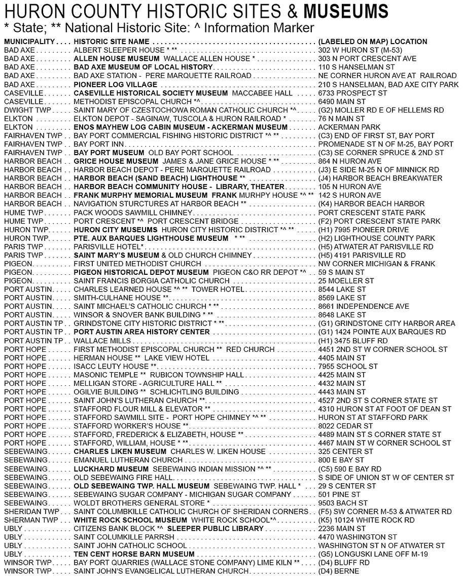
• Historic sites & museums index, primary park facilities inventory.
• Written history of the origin of Michigan place names.
• State and National Forest lands, trails and campgrounds, Commercial Forest Reserve.
• Cemeteries, old place names & ghost towns, old railroads & stations.
• Parks, hiking trails, natural areas, boat launch sites with quality of access.
• Canoe trails, birding hot spots, public swimming beaches.
• Federal township-range numbers, sections & section numbers, civil townships.
And more - see pages that follow
Author & Publisher: David M. Brown
ISBN 13: 979-8-218-99314-6
$43.95 Per Copy
$15.00 Packaging & Shipping
Flat rate per order in Michigan
Out-of-state shipping calculated at checkout
Order by credit card - see menu above
Order by mail - PO Box 11 Bath MI 48808
Payable to David M. Brown
michigancountyatlas@gmail.com
"The rich annotations are a treasure - the historical features and myriad points of interest far exceed those found in other atlases. The geographic and historical information for each county contains excellent information for digging into an area’s past. Photos, specific names and dates. For anyone doing serious research in Michigan, having ranges, towns and section numbers is essential. Water features are consistently and accurately shown. As the various books are examined, it is clear that the spiral binding is an essential part of this useful atlas."
Douglas Johnson

Map sample from Grand Traverse County
Each Michigan County is displayed as an individual entity
Pages 66 & 67: Grand Traverse County, NW Lower Peninsula (pages 11 by 15.5")


Intimate Detail of Rural and Outback Michigan
This week's featured map segment:
Map portion from Gogebic County, western Upper Peninsula

Map portion from Keweenaw County, north tip of the Upper Peninsula

Map portion from Leelanau County, NW Lower Peninsula

Page 155, Newaygo County (page size 11 by 15.5")

Page 154, Newaygo County (page size 11 by 15.5")

Pages 4 & 5: Alger County, west & central (page sizes 11 by 15.5")
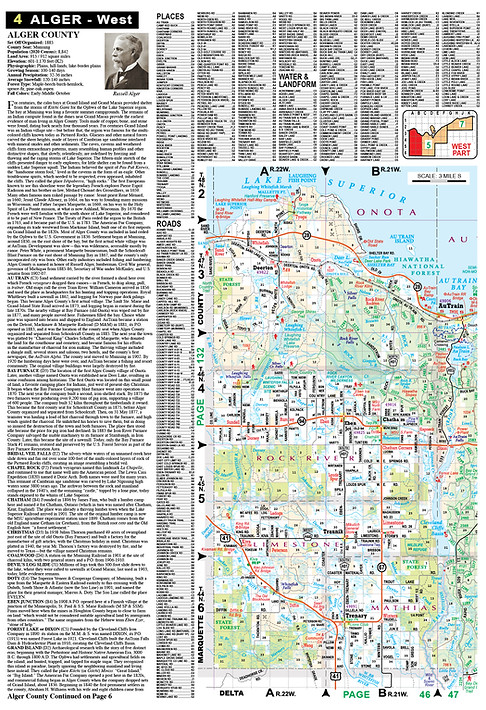
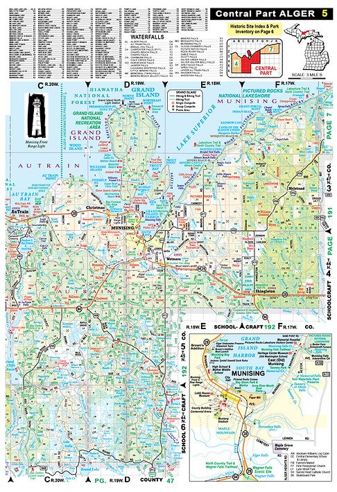
Map portion from Alger County, central UP Lake Superior Shore

Map portion from Tuscola County, Heart of Michigan's Thumb

Map portion from Chippewa County, northeast Upper Peninsula

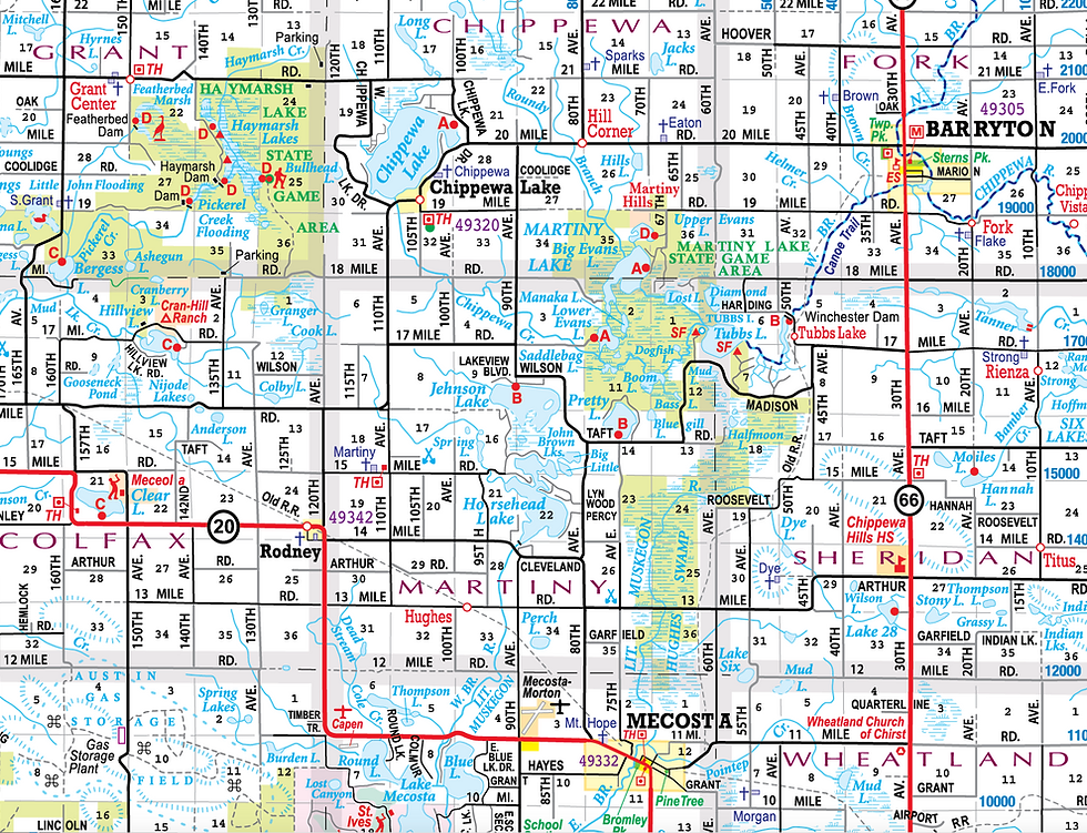
Map portion from Mecosta County, southeast Lower Peninsula
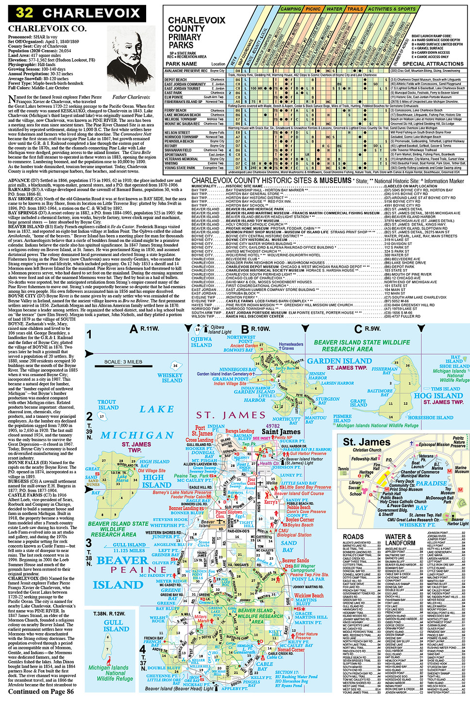
Page 32: Charlevoix County, Beaver Island (page size 11 by 15.5")
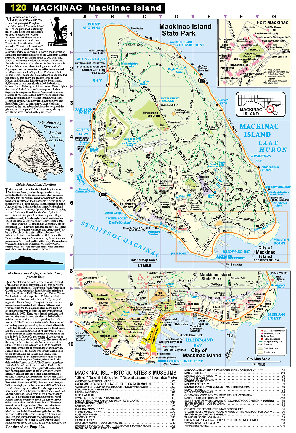
Page 120: Mackinac County - Mackinac Island (page size 11 by 15.5")
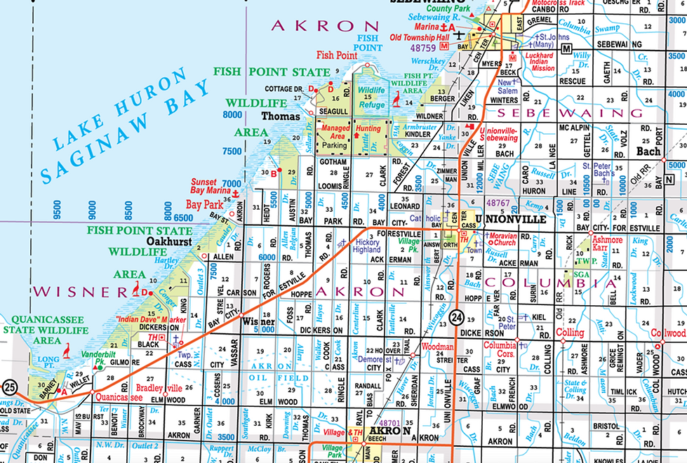
Map portion from Huron County, Michigan's Thumb east shore Saginaw Bay
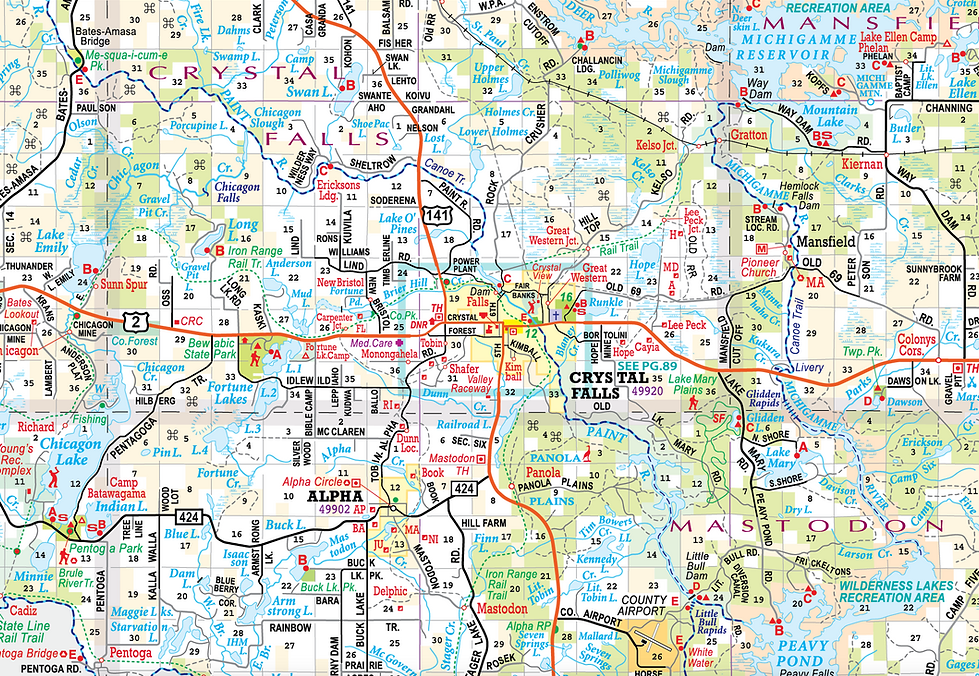
Map portion from Delta County, central UP, north Lake Michigan shore

Map portion from Chippewa County, eastern UP, St. Marys River

Map portion from Lapeer County, southeastern Lower Peninsula

Map portion from Gogebic County, western Upper Peninsula

Map portion from Iron County, western Upper Peninsula
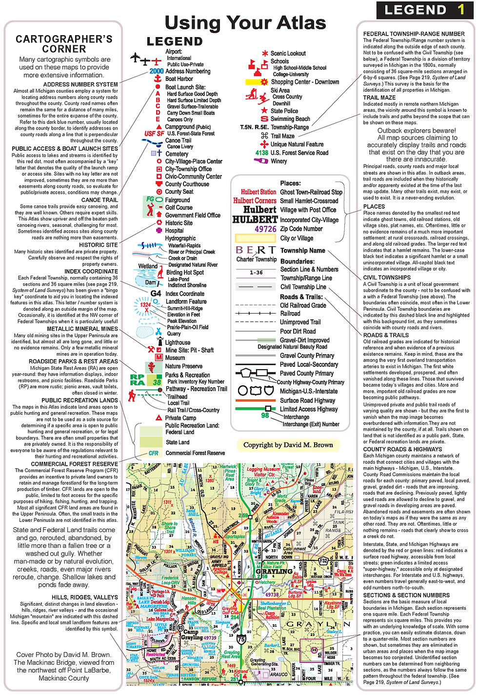
Page One: Map Legend - Using Your Atlas (page size 11 by 15.5")
A concise history of each county & it's many place names


Page 212, Place Name History (page size 11 by 15.5")

Historic Sites & Museums Index Sample
Primary Parks Inventory Sample

Back Cover
